Ukraine has around 132,000 km² of land that may hold landmines and unexploded ordnance. That is 13.2 million hectares, about three times the size of Denmark.
Around 2 million hectares of it is farmland. Today, about 37,400 hectares of farmland are cleared a year. At that pace, clearing Ukraine's contaminated farmland takes around 53 years.
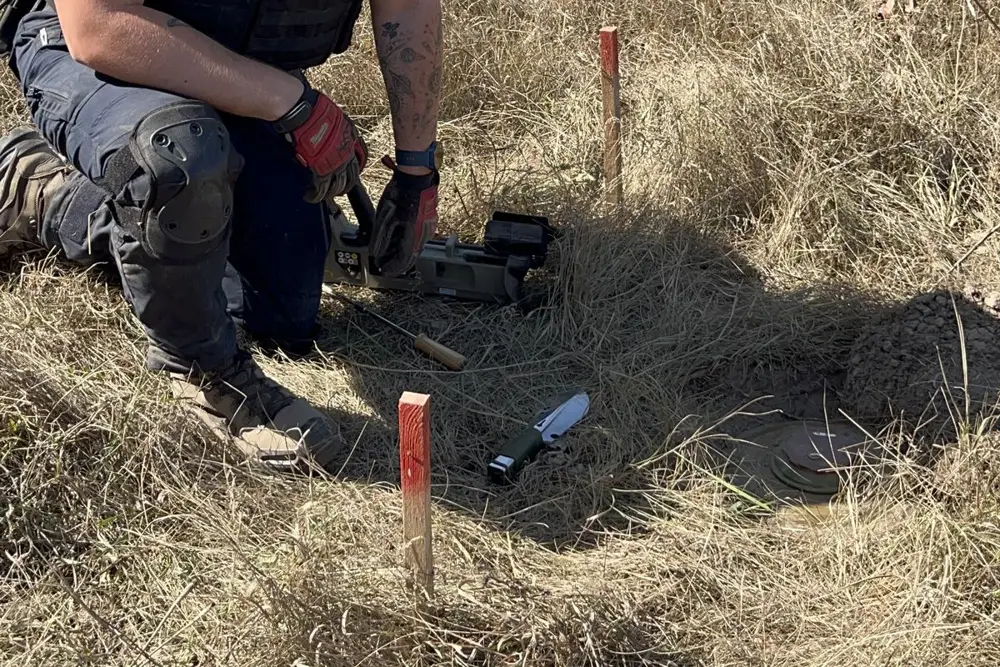
Fifty-three years of fields that cannot be sown. Farmers who cannot go back. Deminers checking the ground on foot, 10 to 50 square metres a day each. Newer tools, such as survey drones, are helping, but the scale of the problem is still far beyond what today's methods can cover.
We believe the first step can be done far faster: finding out where the threats actually are.
One map of what is in the ground
SubTerra Intelligence maps landmines and unexploded ordnance from the air. The core is software.
Up to nine sensor types, such as ground-penetrating radar, magnetometers, LiDAR and cameras, each see part of the picture. Genetix Context Core, deterministic software we hold under exclusive licence, fuses all of it into one map: what is in the ground, and where.
Clearance teams get a map they can work from. They go straight to confirmed targets instead of treating every hectare as a threat.
The airship is the carrier. It lets us bring the sensors over very large areas, low and slow, around the clock.
Speed: one airship against today's pace
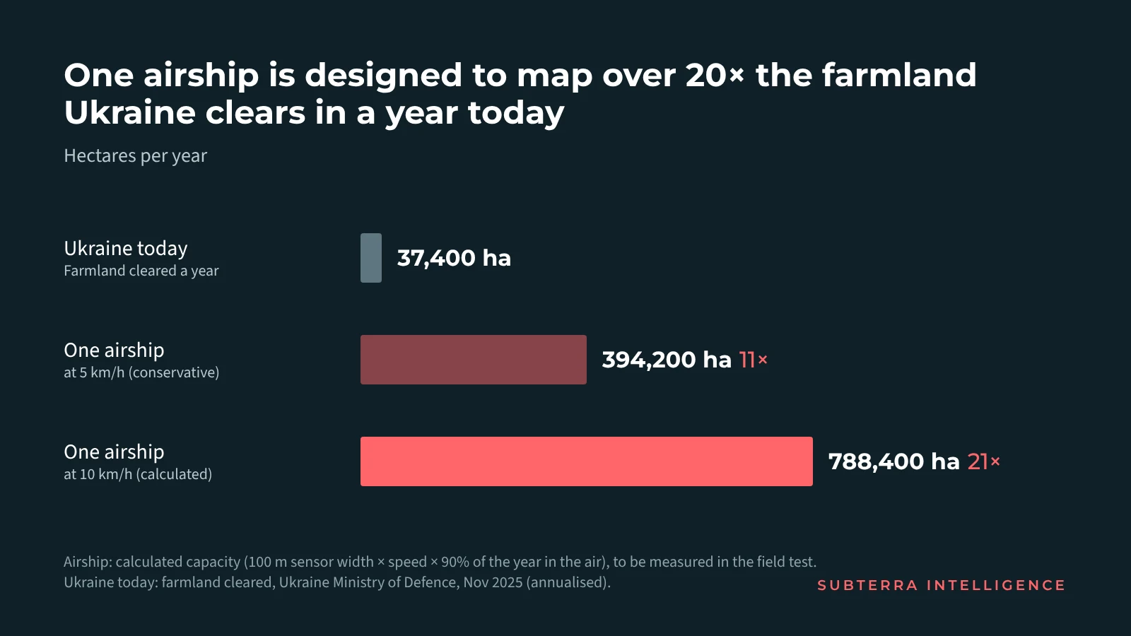
The calculation is simple. Sensors covering a 100-metre-wide strip, at 10 km/h, map 100 hectares an hour. In the air 90% of the year, that adds up to about 788,400 hectares. That is over 20 times the farmland Ukraine clears in a year today. Even at half the speed, it is more than 10 times.
Put another way: at that rate, one airship could map all of Ukraine's contaminated farmland in about two and a half years. At today's pace, clearing it takes 53.
We are not the only ones working on this. Drones carrying magnetometers, ground-penetrating radar and cameras are already in use in Ukraine, and they are a real step forward. On average, drones survey up to about 50 hectares a day. A magnetometer drone used by Ukraine's Ministry of Defence scans a 2-metre-wide strip.
One airship is designed to map about 100 hectares an hour, with the full sensor set on board, around the clock. That is the gap the airship closes.
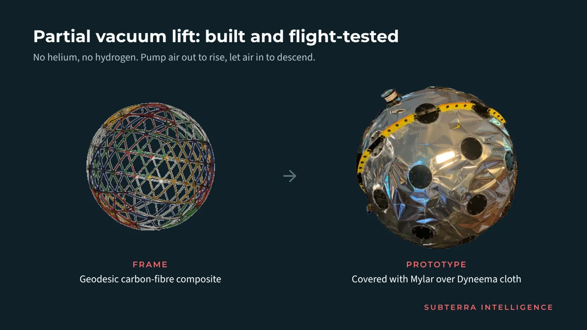
The airship makes this possible. Its lift comes from a partial vacuum, not gas, so there is nothing to leak or refill. Its propellers run on batteries charged by solar cells on the airship. It is designed to stay in the air for days at a time.
Every flight will take place with the approval of Ukraine's authorities, in coordinated airspace.
These are design figures. The field test will measure them.
€117 to map a hectare. €1,170 to clear it.
Ukraine's state pays around €1,170 per hectare for clearance. We price a finished map at €117 per hectare, about a tenth.
Take 100 hectares that turn out to be clean. Clearing them without a map costs about €117,000. Mapping them first costs €11,700, and the clearance budget goes to land that needs it.
A map does not remove a single mine. Clearance teams still do that work. What the map changes is where they spend their time: on confirmed targets, not on hectares that turn out to be clean.
That only works if the map is trusted. In Ukraine, land is released under national mine action standards, set by the country's mine action authorities. Getting our data accepted for that is part of what the field test must prove.
That works for everyone involved:
- The state and donors: clearance money spent where the threats are. Ukraine's clearance need is estimated at €24.7 billion for 2026–2035.
- Farmers and the economy: land back in production years earlier. Contamination costs Ukraine an estimated €10 billion in lost GDP a year.
- Investors: a product that saves the customer about 90% on every hectare that turns out clean, in a market where clearance spending runs to billions of euros a year.
That last point matters for the first two. A business that scales is what makes this go faster. Donor money alone will not map 13.2 million hectares.
Where we are today
We are at technology readiness level 4–5.
- The airship's fuel-free lift principle, a partial vacuum (US-patented), is built and flight-tested.
- Our software is about 90% built. Sensor integration and field validation remain.
- The full-scale airship is not built yet, and nothing is field-proven.
That is exactly what this round is for.
The round: €10M to prove it in the field
We are raising a seed round of €10 million at €30 million pre-money.
It pays for one thing: building our prototype and testing it in the field within 12 months of closing. The test has two numbers to hit, verified independently over at least three months:
- At least 50 hectares mapped per hour in the air.
- At least 99.99% detection of known targets.
When both are met, we build production airships and start mapping at scale, with a Series A to fund the fleet. Alongside the round, we are pursuing non-dilutive funding from allied governments and international programmes, including EU, NATO and UN-backed mine action funding.
Ukraine first
Ukraine is where we start. According to the UN, at least 58 states and territories are contaminated by anti-personnel mines alone. The same platform could work in many of them.
SubTerra Intelligence is a Danish company based in Odense. We chose the air because only from the air can you cover land at the pace this problem needs.
The story of how we got here — from a ground robot to an airship, and the three companies behind it — is in SubTerra Intelligence: why we're mapping mines from the air.
We are talking to investors, funders and partners who want to help move this faster. If that is you, let's talk: hello@subterraintelligence.com · subterraintelligence.com